 Vats Technosoft
Cadastral Survey Services
A cadastral survey is a type of surveying that deals with the measurement and demarcation of land ownership boundaries. Its main purpose is to establish and define property boundaries for legal and administrative purposes, including taxation, land ownership registration, and land use planning.
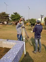
Cadastral surveys are typically conducted by licensed surveyors, who use a variety of tools and techniques to determine the precise location and extent of land parcels. These may include measuring and marking physical features such as trees, rocks, and buildings, as well as using global positioning system (GPS) technology and computer-aided drafting (CAD) software to create detailed maps and boundary descriptions.